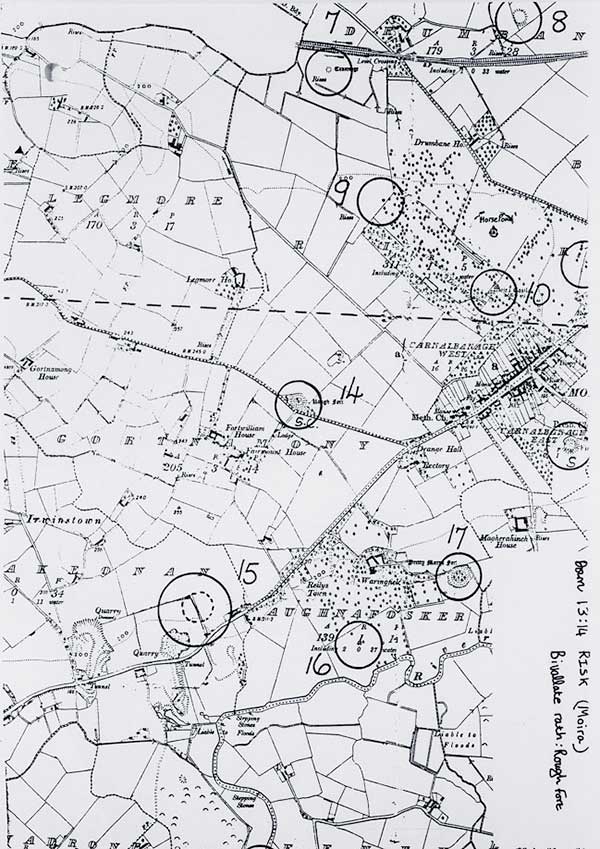
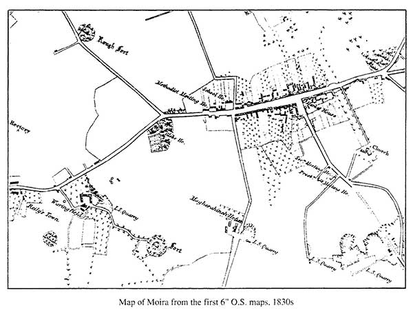
Menu

History of Moira

Discover the history of Moira, County Down

History of Moira
Facebook Twitter Email

Primary Menu

Skip to content
  • Home
  • Articles
  • History for Schools
  • Publications
  • Images
  • Moira Prints
  • Church Histories
  • Links
  • Contact
Search
Home »Category»Schools»Old Maps

Old Maps

Posted on31/10/201728/12/2020Authordavid2hearts

Old map of Moira raths

Moira map 1830

CategoriesSchoolsTagsCounty Down, Earl of Moira, George Rawdon, historical, history of Moira, map, maps of Moira, Moira, Moira Castle, Moira demesne, Moira history, Moira Main Street, Moira village, Northern Ireland, Pretty Mary's Fort, Rough Fort, Sir Arthur Rawdon, Waringfield Military Hospital

Post navigation

← Previous Previous post: Find my house
Next → Next post: The Houses of Moira

Local History Links

local history sites

David’s other websites

David’s web sites

History Articles

  • The village blacksmith
  • Leaving your mark on history
  • The mystery mansion
  • No archaeological interest?
  • Digging up history
  • Castle Foundations
  • Shadows of our past
  • Moira horses and the 1798 Rebellion
  • The Houses of Moira
  • Old Maps

History for Schools

History about Moira for schools
  • Early History
  • The Battle of Moira
  • Inisloughlin Fort
  • Trummery Round Tower
  • Plantation of Ulster
  • Castle and Demesne
  • The residents of the castle
  • Transport
  • Village Buildings
  • Village Life
  • Village Churches
  • The Tunnel
  • Old Maps
  • Street views
  • The Four Trees
  • Famous people from Moira
  • Famous visitors
  • World War II
  • Moira in Bloom
  • Schools in Moira
  • Find my house
  • 100 years from now
Copyright © 2025 History of Moira. All Rights Reserved.
Catch Base by Catch Themes
Scroll Up
  • Home
  • Articles
  • History for Schools
  • Publications
  • Images
  • Moira Prints
  • Church Histories
  • Links
  • Contact