
Inisloughlin Fort
Note: Historically the name of the fort has had at least five different spellings
After the Battle of Moira, the next major record of life in the Moira area comes from the late 16th and early 17th Century. Hugh O’Neill, Earl of Tyrone, was engaged in a campaign against the English in Ireland known as the Nine Years War.
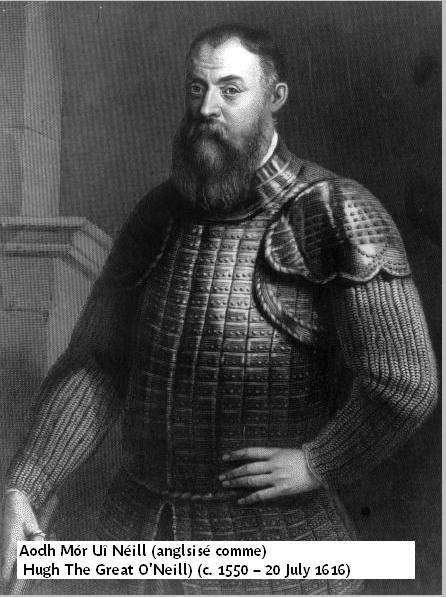
© Copyright This image is reproduced courtesy of the National Library of Ireland PD TYRO-HU (3) 1 http://www.nli.ie/
O’Neill had a Fort at Inisloughlin, just off the Hillsborough Road. It was also close to a ford on the Lagan at what we now call Spencer’s Bridge. The Fort was 40 yards (more than 36 metres) square with corner bastions.
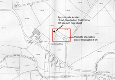
Drawing showing the location of Inisloughlin Fort
The above image comes from QUB Geophysical report read here
A large reward was offered for O’Neill’s capture, dead or alive. Eventually Sir Arthur Chichester and his English soldiers surrounded and captured Inisloughlin Fort in August 1602.
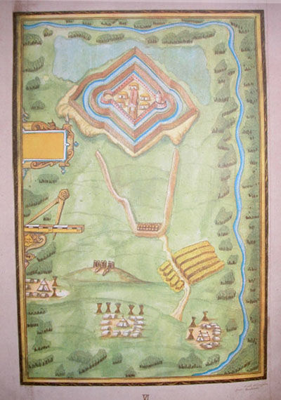
Richard Bartlett’s Map of Inisloughlin Fort 1602 © Copyright This image is reproduced courtesy of the National Library of Ireland MS 2656 (6) http://www.nli.ie/
This weakened O’Neill’s power and robbed him of vast treasures he had hidden in the Fort. Soon he fled from Ireland in what was known as the Flight of the Earls. Lisburn and the territory around here, including the captured Fort, were given to Sir Fulke Conway.
Capt. Henry Spencer was Governor of the Fort in 1623. Spencer’s Bridge close to the Fort was possibly built by him or named after him. The fort was levelled in 1803 but one small part still survived in 1837. (The Castles of Ireland Compiled by Lee Johnson and Lewis Topographical Dictionary, 1837)
Archaeologists are still trying to unearth the exact location of the Fort of Inisloughlin.